
In the Field
A Case Study
Learn how one DOT utilized OnStation to empower inspection staff to know their location using digital stationing.

THE CHALLENGE
location, location, location
“How do we empower our inspection staff to know where they are on a project without the stake?”
State DOT, e-Construction Administrator
LOCATION
Digital delivery is here!
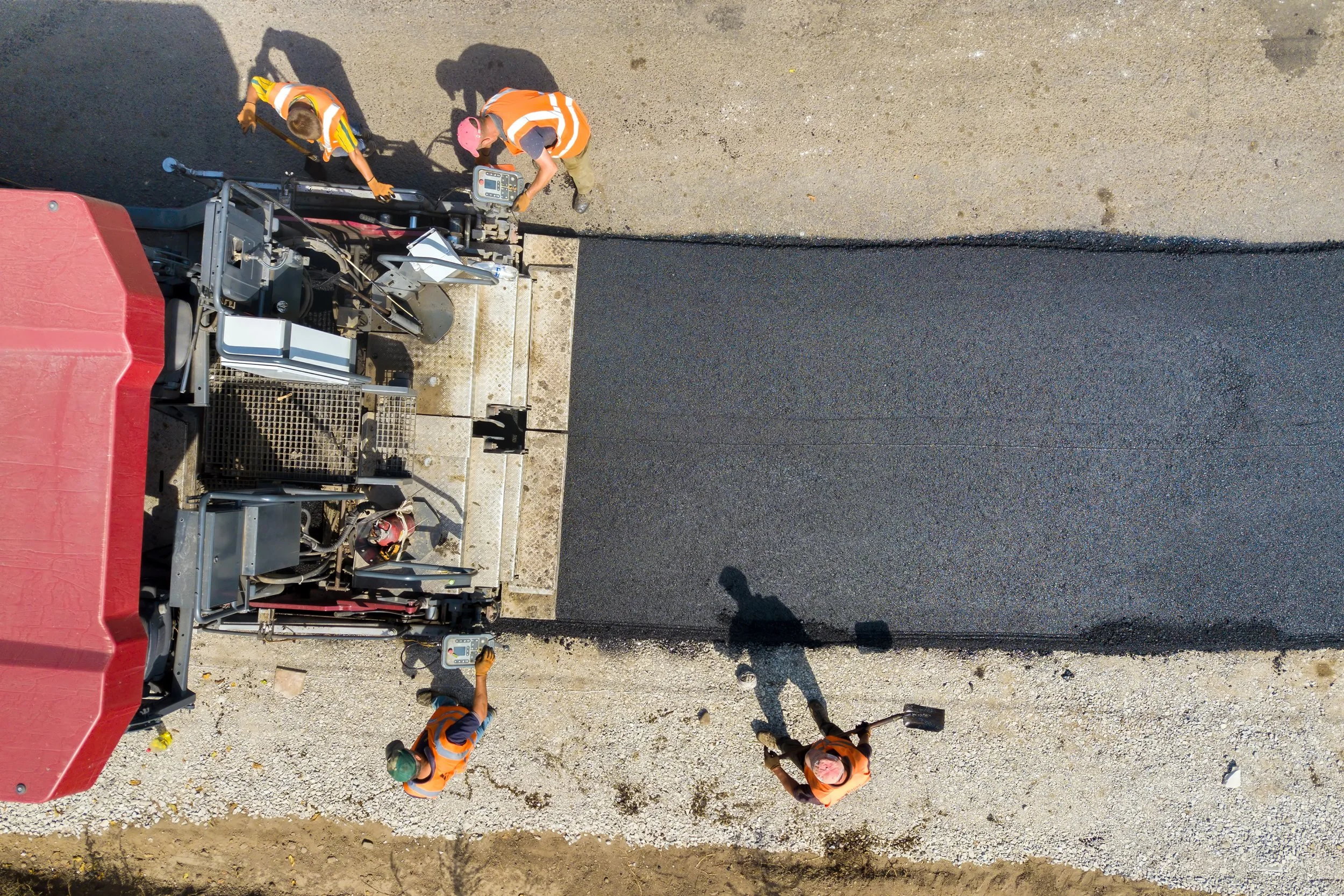
The DOT spends a significant number of resources designing projects and developing CAD files (DGN, DWG, XML, ALG, etc.) that include stationing to be utilized during construction. These digital files are provided to contractors to plug into their dozers and other equipment eliminating the need for physical stationing. With no stakes in the ground, the inspection staff has a hard time understanding where they are on the project.


THE SOLUTION
“Everything in construction has a where and that where is very important.”
State DOT, e-Construction Administrator
digital stationing
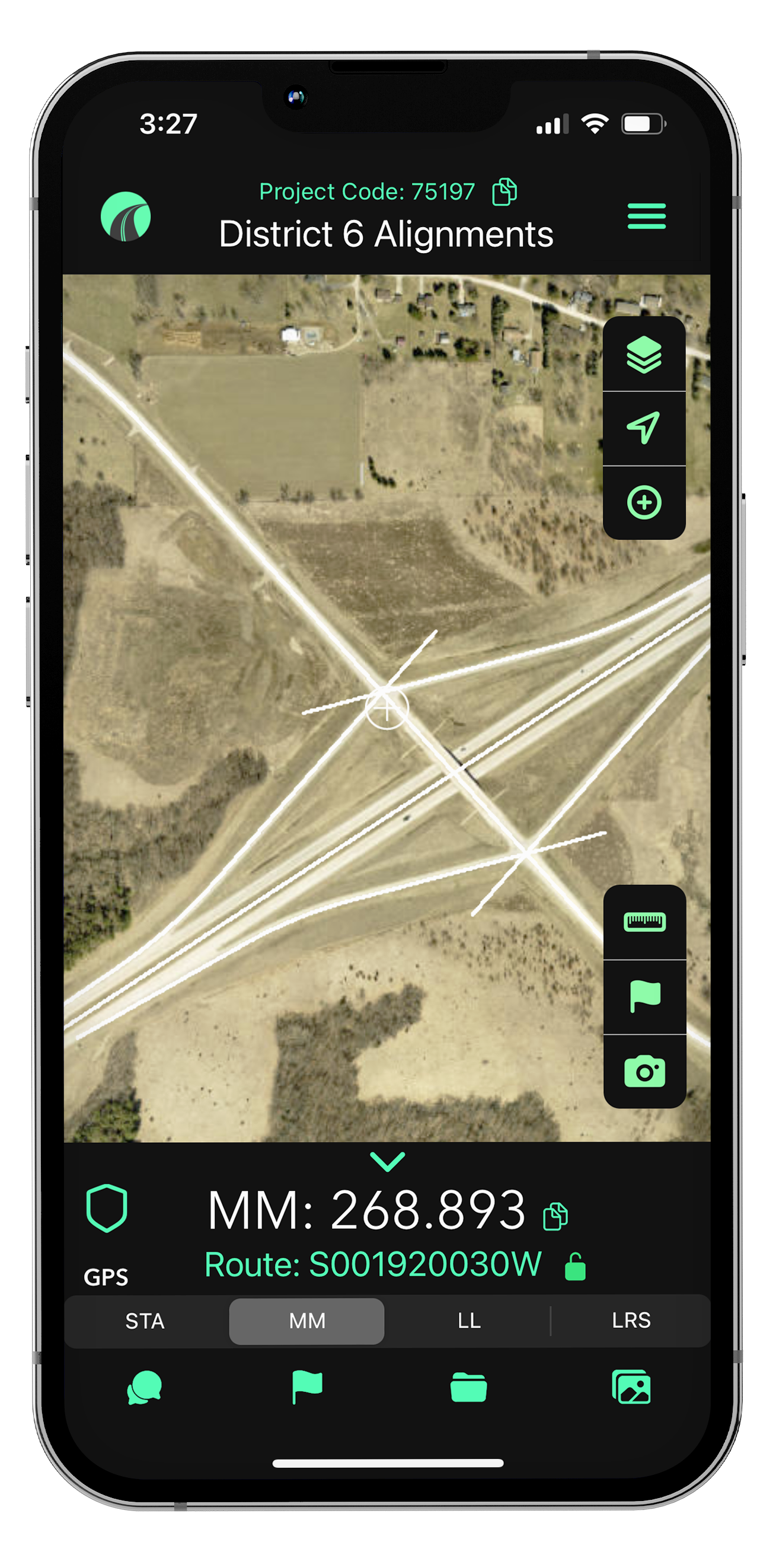
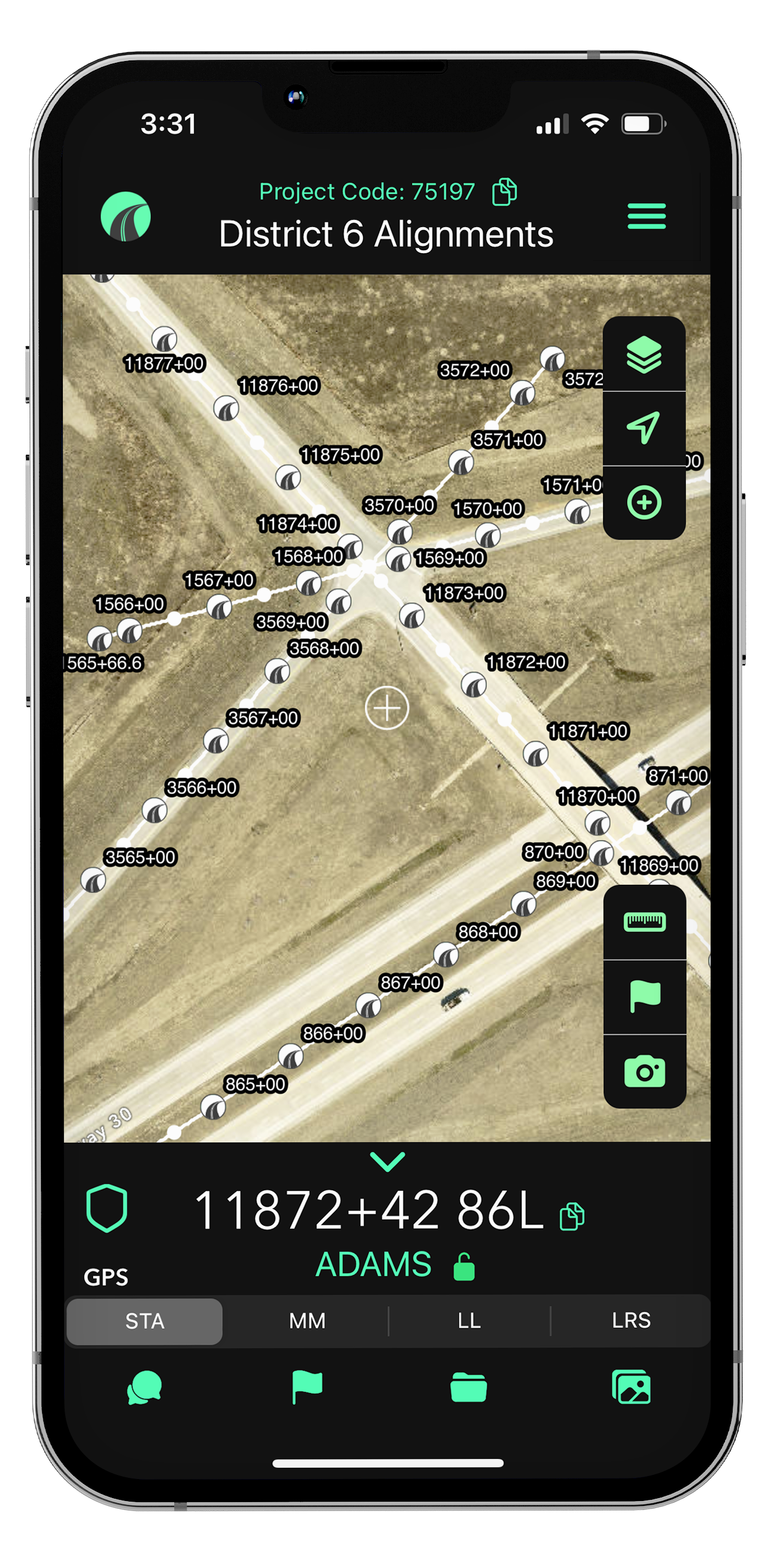
To address this challenge, the DOT gave their inspectors access to live digital stationing on their phone/tablet using the OnStation App. The CAD files with alignment data are uploaded into the app by the OnStation team, providing users with live linework and location information directly tied to the project plans.
How It Works
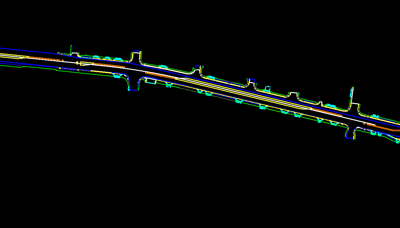
Digital Project Display
The DOT can now view a digital project display at scale, across all projects in the state. This display within the OnStation App offers live station alignments and offsets, with selectable design layers turning the CAD files into powerful project information. More than simple alignments, the app allows for a comprehensive view of the project scope, including:
Design linework, viewable in layers
Updated aerial imagery with current drone footage
Additional GIS data
Key Features
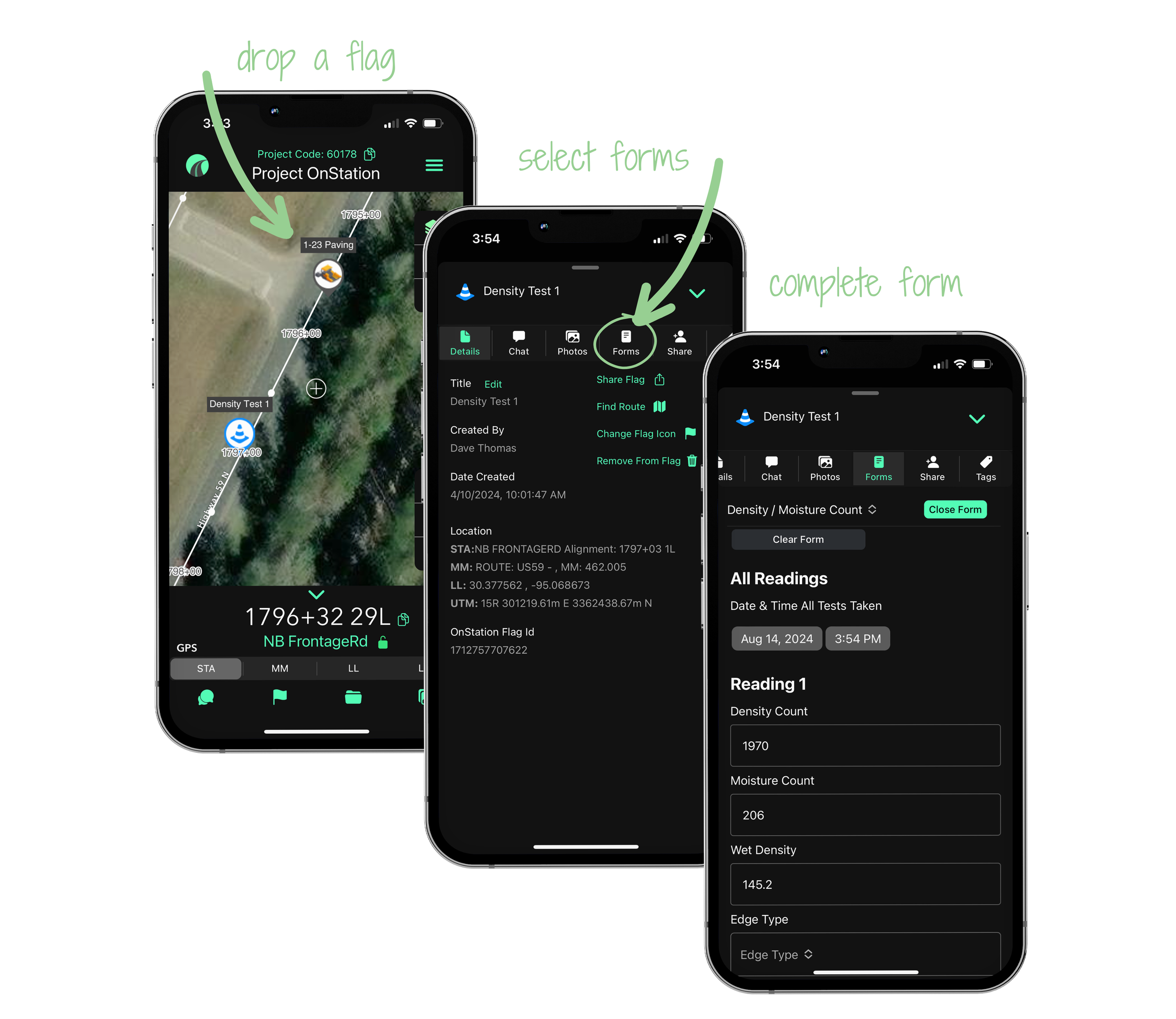
Flag & Chat
Inspectors drop virtual “flags” on the project map corresponding to a specific station or station offset. Each flag includes the date, time, location, user information, station, and additional notes or picture documentation deemed important by the inspector.
Use Cases:
Reporting: Storm Water Deficiencies
Location: Subdrain Outlets
Tagging: by Pay Item
Digital Forms
The DOT converted existing PDF forms, like those used for Storm Water Deficiencies, into smart, dynamically formatted digital form. Inspectors can drop a flag, select the appropriate form, and enter the information directly into the OnStation App. This data can then be filtered and exported into a csv file for download.
THE RESULT
“I have inspectors calling me now on a bridge approach project that’s 70 feet long and they want an alignment built because using OnStation is just that handy for them.”
State DOT, e-Construction Administrator
improved reporting
With the OnStation App, DOT inspectors can now access live digital stationing, allowing them to view their location on the jobsite and link documentation to specific stations and offsets. This has led to more accurate and efficient reporting, as well as enhanced project management capabilities. Inspectors can easily flag and document project details, use dynamic digital forms, and view comprehensive project information such as design linework, drone footage, and GIS data. As a result, inspectors are now requesting digital alignments for features not traditionally covered, like bridge approaches, to further improve documentation accuracy.
THE ADDED BENEFIT
alignment database
“The alignment database will make the process of creating GIS files for other projects such as right-of-way and patching more efficient.”
State DOT, e-Construction Administrator
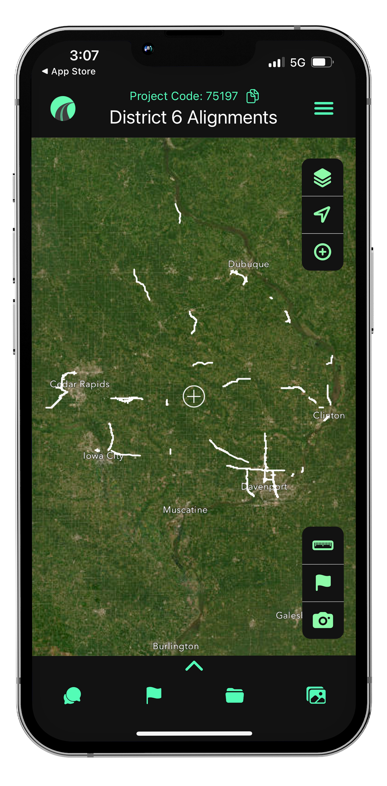
Realizing the power of OnStation, the DOT requested that OnStation build no-stationing projects for each district within the state, incorporating any existing stationing alignments and all available open GIS data. These district projects function as a statewide alignment database used for various purposes, including as-builds, maintenance, and design.
As Builds
When future as-build projects are needed, there’s no need to recreate the alignment since it already exists. Additionally, all data from previous projects that used OnStation, including work-logs and installation information, remains accessible within the app. For example, you can easily reference details like when a guardrail was installed, the manufacturer, and other pertinent information captured in the app.
Maintenance
Maintenance crews are using OnStation to flag areas that require attention, such as patching locations. This allows the construction team to investigate and build a database of patching needs, complete with mile marker and LRS coordinates.
Design
During project design, critical information, such as the location of farm field tile or patching needs (as mentioned above), can be flagged in the app. Mile marker and LRS coordinates can then be downloaded from the app and given to designers to assist in creating accurate alignments.
STA: 1786+45 14R
=
MM: 461.991
=
LL: 30.380179,-95.067204
=
LRS: 461.458 2L
=
STA: 1786+45 14R = MM: 461.991 = LL: 30.380179,-95.067204 = LRS: 461.458 2L =
From the Field

FREE Stationing Training
Our stationing experts created these training videos to help individuals in the industry learn about the most important aspect of a job… Location!

Stationing is the project locationing system that allows individuals to budget, design, and construct roadway projects. The following lessons will cover the different types of stationing and why they are important.