

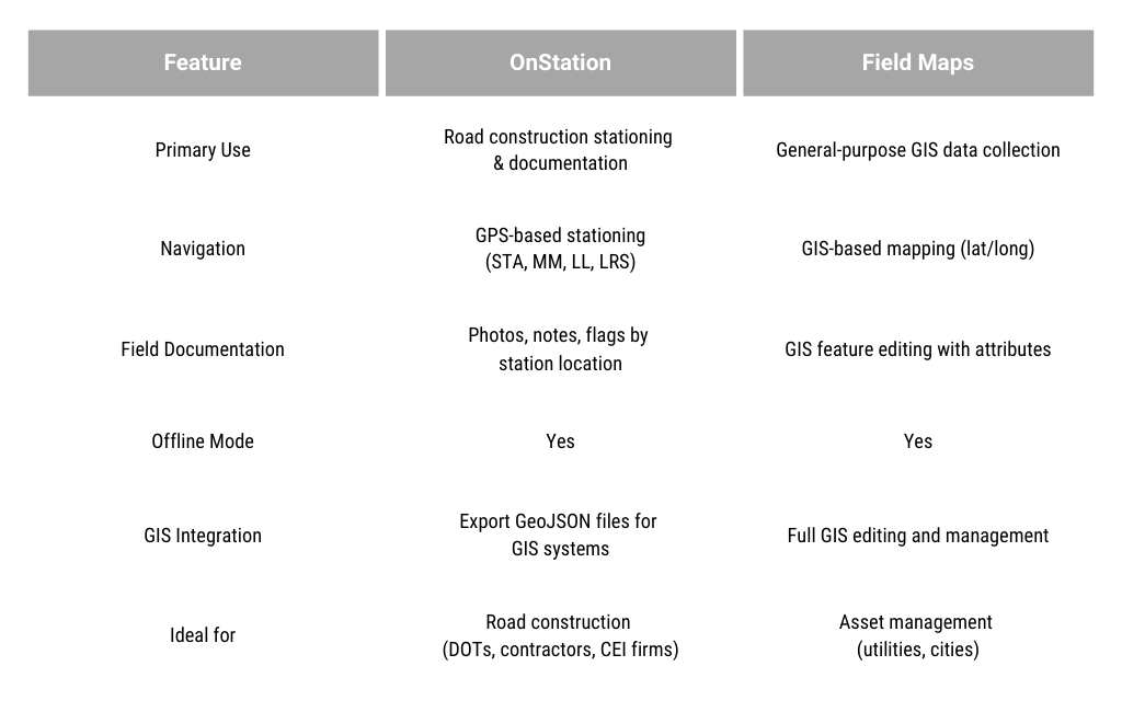
OnStation vs. Field Maps
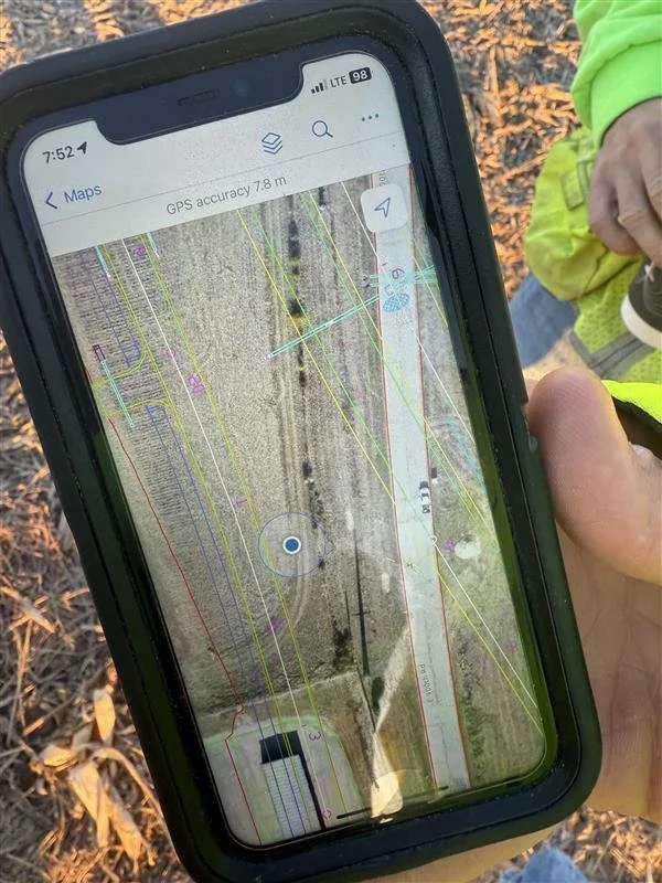
“Not everyone in the field has access to a GPS rover. With OnStation, you can verify your location with your phone.”
OnStation starts with the location, providing live station/offset and location-based documentation, ideal for field use. Field Maps is a GIS asset management tool that manages complex datasets but lacks specialized stationing functionality.
What’s the
main difference?
OnStation
LIVE STATION OFFSET IN THE FIELD
Real-time GPS Stationing: Instantly know your location on the jobsite in reference to station, mile marker, lat/long, LRS.
Document Field Data: Capture photos, notes, flags, and complete forms from the field with station/offset reference.
As-builts Verification: Mark work progress, completion, log test results, and flag issues with time, date, and station stamped location.
GIS Integration: Streamline the creation of as-built documents and export GeoJSON files for GIS systems.

Field Maps
GIS-Based Mapping & Data Collection
Map-Driven Navigation: Display GIS layers and maps with asset information (no station reference).
Data Collection & Editing: Add, edit, and update GIS features (points, lines, polygons).
Forms and Attributes: Collect detailed data through custom forms.
Advanced GIS Integration: Fully integrates with ArcGIS Pro, ArcGIS Online, and Enterprise.

If you need long-term GIS management or asset tracking, using both OnStation and Field Maps together can be beneficial.
When to
use both?
STA: 1786+45 14R
=
MM: 461.991
=
LL: 30.380179,-95.067204
=
LRS: 461.458 2L
=
STA: 1786+45 14R = MM: 461.991 = LL: 30.380179,-95.067204 = LRS: 461.458 2L =
From the Field

FREE Stationing Training
Our stationing experts created these training videos to help individuals in the industry learn about the most important aspect of a job… Location!


Stationing is the project locationing system that allows individuals to budget, design, and construct roadway projects. The following lessons will cover the different types of stationing and why they are important.