
Inside Florida’s I-4 Corridor: Tracking Progress & Tackling Challenges Head-On
Managing documentation on large-scale highway projects is a constant challenge, but for Chris Lundberg, a senior CEI inspector with architecture, engineering, and consulting firm RS&H, the OnStation app has transformed the process. Working on a 13-mile stretch of Central Florida's busy I-4 corridor, Chris faces the daunting task of tracking and organizing hundreds of work items—including temporary barriers, type-2 barricades, milling existing asphalt, sidewalk installation, and guard rail placement. With 25 years of survey experience before becoming an inspector, he knows accurate documentation starts with location.
The Challenge: Managing Massive Amounts of Data
On a daily basis, Chris has to capture and organize evidence of ongoing and completed work. This includes taking pictures, writing notes, and later transferring them to the project's daily diary. Sometimes it is difficult to distinguish between similar images on a project that spans several miles, which can lead to potential gaps or errors in documentation. "On a busy day, I’m spread thin and don’t have time to write things down," Chris explains. "With OnStation, I just drop a flag, take a picture, and add a few notes."
The Solution: OnStation's Geo-Referenced Documentation
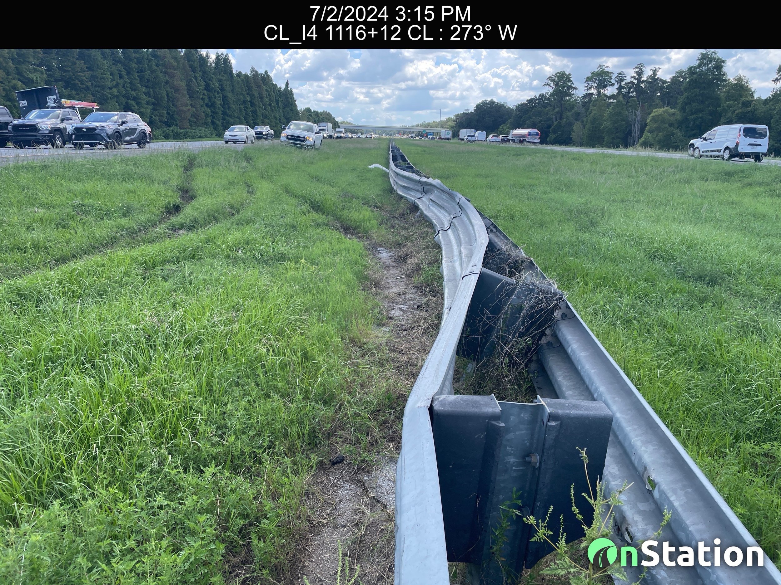
Guard rail damage caused by an accident documented within the OnStation app with station location and a date/time stamp.
One of the most valuable features Chris utilizes is the ability to geo-reference images. This function ties each photo and note to a precise station, providing a clear visual of on-going construction and the overall project. "The images start to look the same after a while, but with OnStation, I can see exactly where the work was done, that’s a game changer," Chris says, noting that his documentation is more thorough and accurate.
This feature proved invaluable when investigating damage to a guard rail. Chris recalls, "I just pulled up the app, navigated to the location, clicked on the flag that was dropped there, and saw that there was an accident three months earlier." This quick access to historical data allowed him to resolve the issue efficiently without scrolling through several months of images on this phone.
Streamlining Work Verification and Reporting
Chris also leverages OnStation's flagging system to track and verify work completion. He has developed a customized system where specific flag icons represent different types of work or issues. "I’ve started linking flags to line items. For example, the red cone icon is for property damage. I have 65 of them right now," he explains. This structured approach helps him quickly sort and export data by line item, ensuring comprehensive records for audits and project oversight.
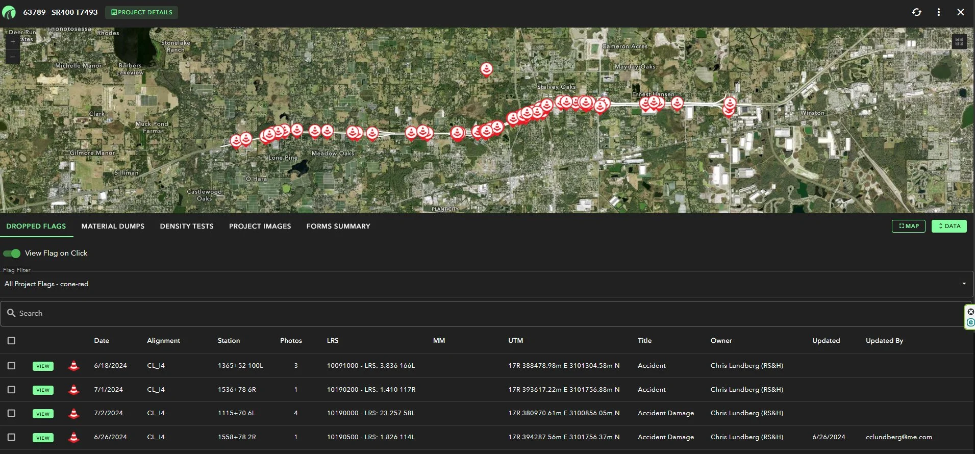
Overview of all property damage “flags” (red cones) in the OnStation data portal.

Proof of sign installation showing installation date to document in OnStation.
Additionally, Chris uses OnStation to task his inspectors with confirming when work is finished. "I give the inspectors a list of signs to confirm installation, have them take an image of the installation date on the back of the sign, drop a flag, and now I have a record of completion with station reference that’s time and date stamped," he says. This process creates a verified project record that is easy to access for proof of compliance.
Enabling Collaboration Across Teams
The benefits of OnStation extend beyond individual use. Chris emphasizes how transformative it would be if all stakeholders adopted the platform. "It will change things if everyone is using it," he says. With shared access, the project administrator, the Department of Transportation (DOT), and contractors can collaborate more effectively.
For example, during project walk-throughs, DOT employees often document missing items. Without OnStation, they estimate locations, leading to potential confusion. "If there’s a station board missing, they could just drop a flag, take a picture, and make a note. Then I can easily walk up to where they dropped the flag, fix it, document completion, and send verification to the DOT within the app," Chris explains.
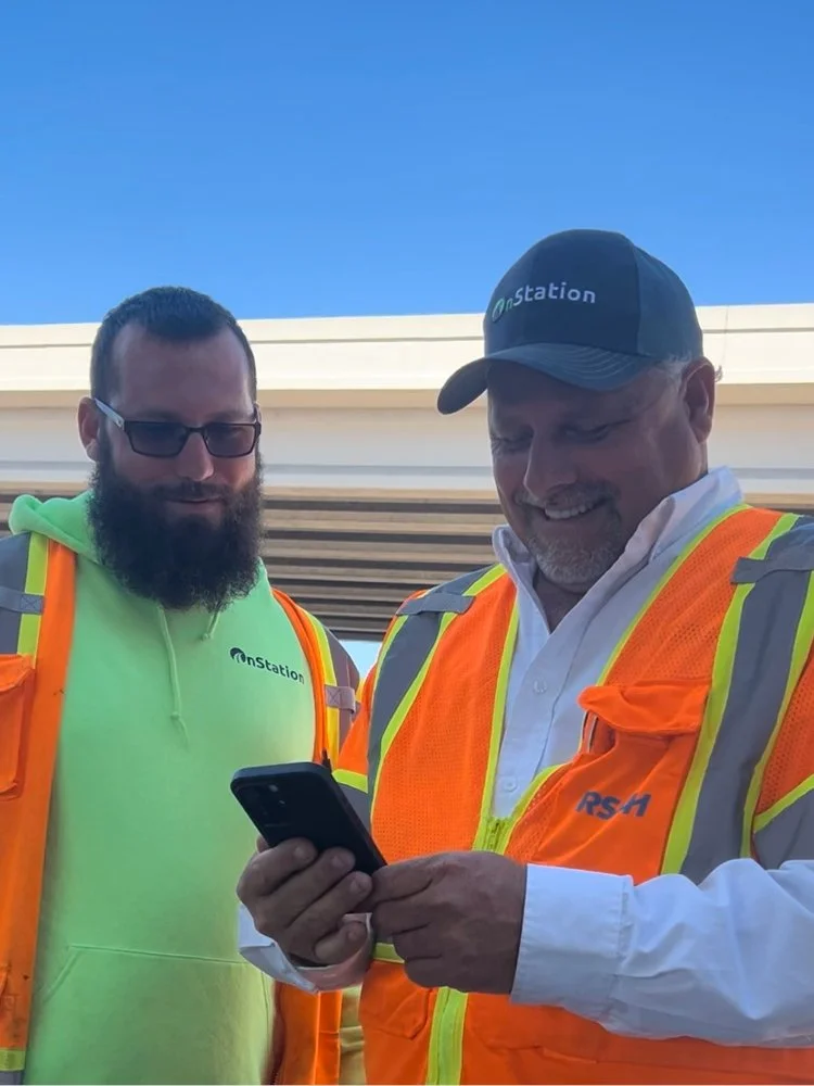
Chris Lundberg (right) documenting work completion with teammate Josh Lawton (left).
The Future of Highway Documentation
Chris Lundberg's experience on the I-4 corridor project highlights how technology is revolutionizing highway construction documentation. By combining geo-referenced images, customizable flagging, and real-time collaboration, OnStation not only enhances accuracy and efficiency but also fosters seamless communication across all project participants. Maintaining accurate As-Built records through documentation that starts with location is crucial to future maintenance and managing long-term infrastructure health.

“I love hearing real-life stories of how OnStation is being used in the field. We sent our very own Ward Zerbe to shadow Chris for a day and observe how Chris is using the app. Ward’s observation, “Chris runs his cell phone like a teenager. It’s his right hand in the field.” I’m so glad to hear OnStation is that valuable to Chris, because we all know what happens when we take the phone away from our teenagers - chaos! ”
OnStation Unveils Groundbreaking Alert System to Protect Road Workers and Drivers
“The injury and fatality data for roadway construction is daunting. If we can get the average driver to understand there are hard working men and women coming…”
OnStation, the leading provider of live digital stationing solutions for the heavy highway industry, announced today a new product that prioritizes jobsite worker safety. Active Worksite™ allows all OnStation App users to notify the traveling public of “workers ahead” using connected navigation apps powered by an integration with iCone. This new technology introduces a never-before-seen alert for drivers and communicates the urgency of slowing down in construction zones where workers are present.